
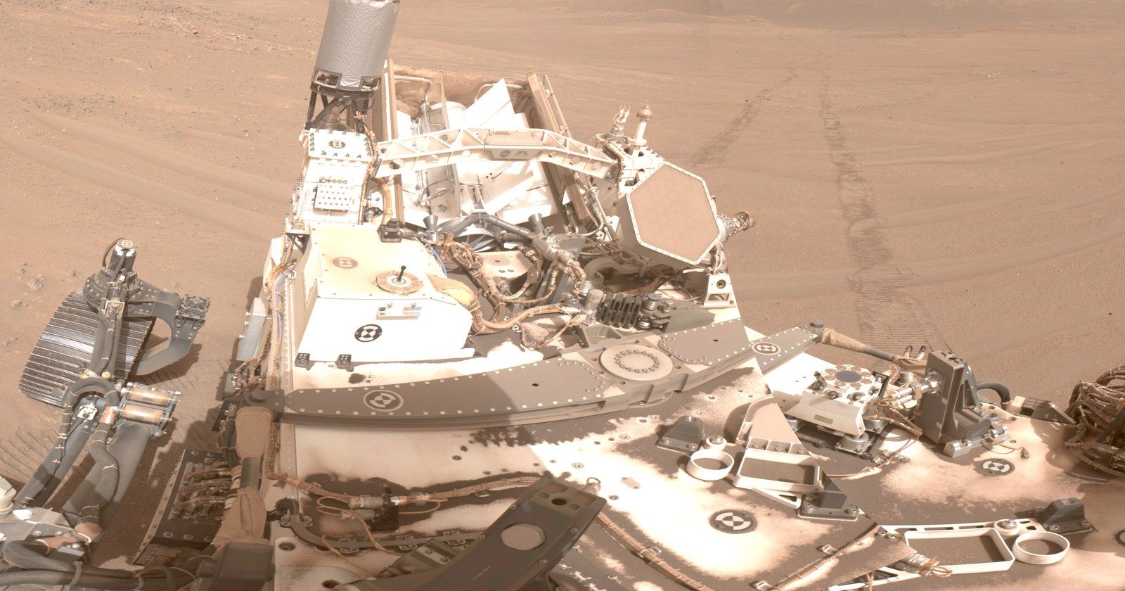

There is no GPS on Mars. For five years, NASA’s Perseverance rover has estimated its own position as it drives, then waited for people on Earth to confirm where it actually is.
On February 18, 2026, NASA announced that the rover can now do that job itself. According to NASA, a system called Mars Global Localization compares the rover’s navigation camera photos with orbital maps stored on board and pinpoints its location in roughly two minutes of processing. NASA describes the accuracy as about 10 inches (25 centimeters); published benchmark results vary by location. The system was first used in regular operations on February 2.
The surprising part is the hardware: the calculation runs on an existing smartphone-era processor that was already aboard for a different job. Here’s how engineers repurposed that processor for navigation, and how they made its answers trustworthy.
Why Perseverance Kept Losing Track of Itself
Perseverance tracks its movement with visual odometry. As it drives, it photographs the ground every few feet and measures how rocks shift between frames to work out how far it has moved, correcting for wheel slip.
Each measurement carries a tiny error, and the errors stack up, like counting your steps through a dark house. NASA says that on long drives, the rover’s position estimate can drift by more than 100 feet (up to 35 meters). Unsure whether it’s too close to hazardous terrain, the rover may stop early and wait. “Humans have to tell it, ‘You’re not lost, you’re safe. Keep going,'” Vandi Verma, chief engineer of robotics operations for the mission, said in NASA’s announcement.
The old fix was manual: the rover sent a 360-degree panorama to Earth, mapping experts matched it against images from the Mars Reconnaissance Orbiter, and the team radioed back its location. NASA says that could take a day or more.
How Ground Photos Get Matched to a Map From Orbit
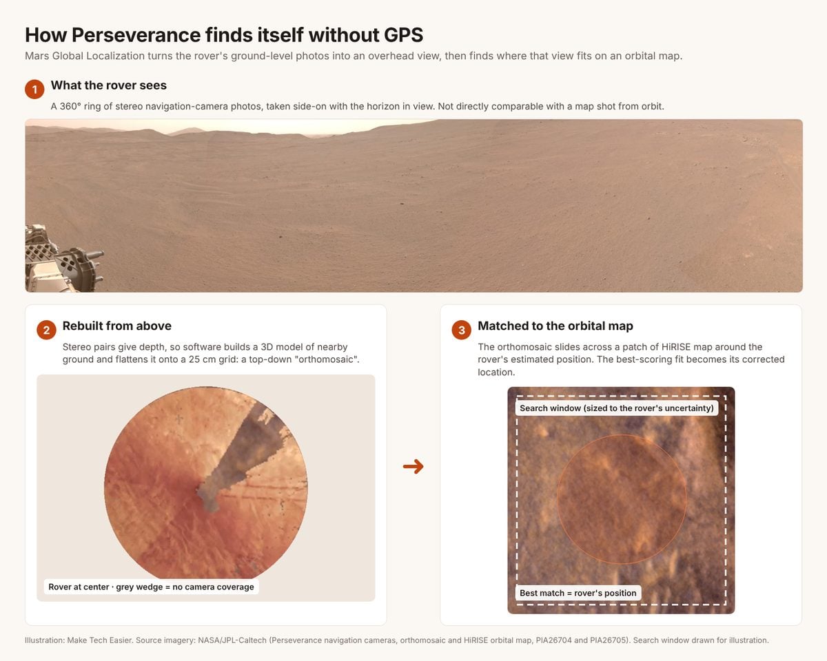
The rover sees rocks side-on with a horizon in the distance; the orbiter looks straight down. Comparing them directly is like finding your street on an aerial map using only a photo from your front porch. So the engineers first turn the rover’s view into an orbiter’s view. The JPL team’s technical paper describes the process.
- Shoot a full circle in stereo. The navigation cameras work in pairs, like eyes. The rover captures a 360-degree panorama, typically five stereo pairs, and uses the red channel because it best resembles the orbiter’s HiRISE imagery. Lighting is evened out so exposure differences don’t distort the result.
- Rebuild the ground, then flatten it. Because each camera pair sees the scene from two slightly different positions, software calculates how far away every point is, producing a 3D model of the surrounding terrain. That model is projected straight down onto a grid of 25-centimeter squares, the same resolution as the orbital map. The result is a circular top-down image called an orthomosaic: the ground as it would look from above.
- Slide it across the map until it fits. The rover crops the orbital map to the area its odometry says it’s probably in, with a margin as wide as its uncertainty. It then slides the orthomosaic across that patch, scoring the fit at each position. The best score becomes the corrected location.
The scoring uses a clever trick. Rover and orbiter photos are taken under different light and shadows, so the algorithm uses a census transform, which records whether each pixel’s neighbors are lighter or darker. That pattern survives lighting changes far better than raw brightness. The team also compares reconstructed terrain heights against an orbital elevation map.
Why a Smartphone Chip Was Already on Mars
That’s heavy computing, and Perseverance’s two main computers are built for radiation tolerance, not speed. NASA notes they’re based on hardware introduced in 1997.
The faster option came with the Ingenuity Mars Helicopter. To talk to it, Perseverance carries a Helicopter Base Station. Because Ingenuity was a technology demonstration, NASA was willing to use commercial chips not yet proven in space. The technical paper identifies the base station’s processor as a Qualcomm Snapdragon 801, the chip family behind 2014 flagship phones such as the OnePlus One and versions of the Samsung Galaxy S5.
NASA says it runs more than 100 times faster than the rover’s main computers. Engineers repurposed computing capacity in the base station for rover localization. Work was already underway before Ingenuity’s flights ended: the team’s earlier paper describes an onboard demonstration on Mars, and the helicopter went on to complete 72 flights. “It’s almost like a gift,” Verma said in NASA’s announcement. “Ingenuity blazed the trail, proving we could use commercial processors on Mars.” On a flight-identical test rover on Earth, the paper reports, a five-pair localization run on the Snapdragon took 81 seconds. The image-processing calculation is only part of the operation, though. Transferring the input data between the rover’s computers takes longer, about 30 minutes according to a 2026 JPL engineering paper, although that transfer can overlap other rover activities.
How Engineers Made a Phone Chip Trustworthy
A consumer processor isn’t hardened against radiation like the main computers, and a wrong location fed into the self-driving system could steer the rover toward the terrain it’s meant to avoid. The JPL team describes two safeguards.
Keep the program away from bad memory. During testing, two localization runs disagreed by just 1 millimeter. That was a difference between calculations, not a measurement of the rover’s true position error. Engineers subsequently found weakened or stuck memory bits and, as the 2026 engineering paper describes, developed software to keep the localization program away from affected memory pages.
Run it more than once, then check. The rover runs the calculation repeatedly, and its radiation-hardened main computer checks that the results agree within set tolerances and pass other validity checks before accepting the update.
What “Within 10 Inches” Really Means
The 10-inch figure is NASA’s stated precision for the system, not a guarantee for every stop. In the team’s earlier published benchmark across 264 past rover stops, the average error was 0.36 meters (about 14 inches), with a worst case of 1.07 meters, measured against locations produced by human mapping experts. The most common error was about one orbital map pixel, or 25 centimeters.
By correcting accumulated position uncertainty onboard, the upgrade can let Perseverance complete longer planned drives without waiting for Earth-based localization. It removes one constraint on autonomous driving; it doesn’t remove the need for suitable maps, safe terrain and enough power.